Yorkville street- scape master plan & FOrm-based code
Following Yorkville’s recently adopted popular comprehensive plan, Yorkville launched a streetscape master plan and overlay form-based code to guide development in its historic downtown. While the area is already a local draw with new restaurants and attractions along the Fox River, the main street is a truck thoroughfare, walkability is lacking, and other neighboring communities can be a stronger draw.
This streetscape plan and code develops street typologies and potential future conditions for five different street types, and outlines short-and long-term recommendations for each. As a testament to the accessibility and resonance of the plan, City staff began implementing strategies before the draft plan was complete. Similarly, the draft code was developed in tandem with the City to ensure developer proposals informed the recommendations, and vice versa. The result is an actionable draft plan and code to activate the downtown area into a walkable, diverse destination.

Client: United City of Yorkville
Location: Yorkville, IL
Year: 2018
Project Area: 9 Acres

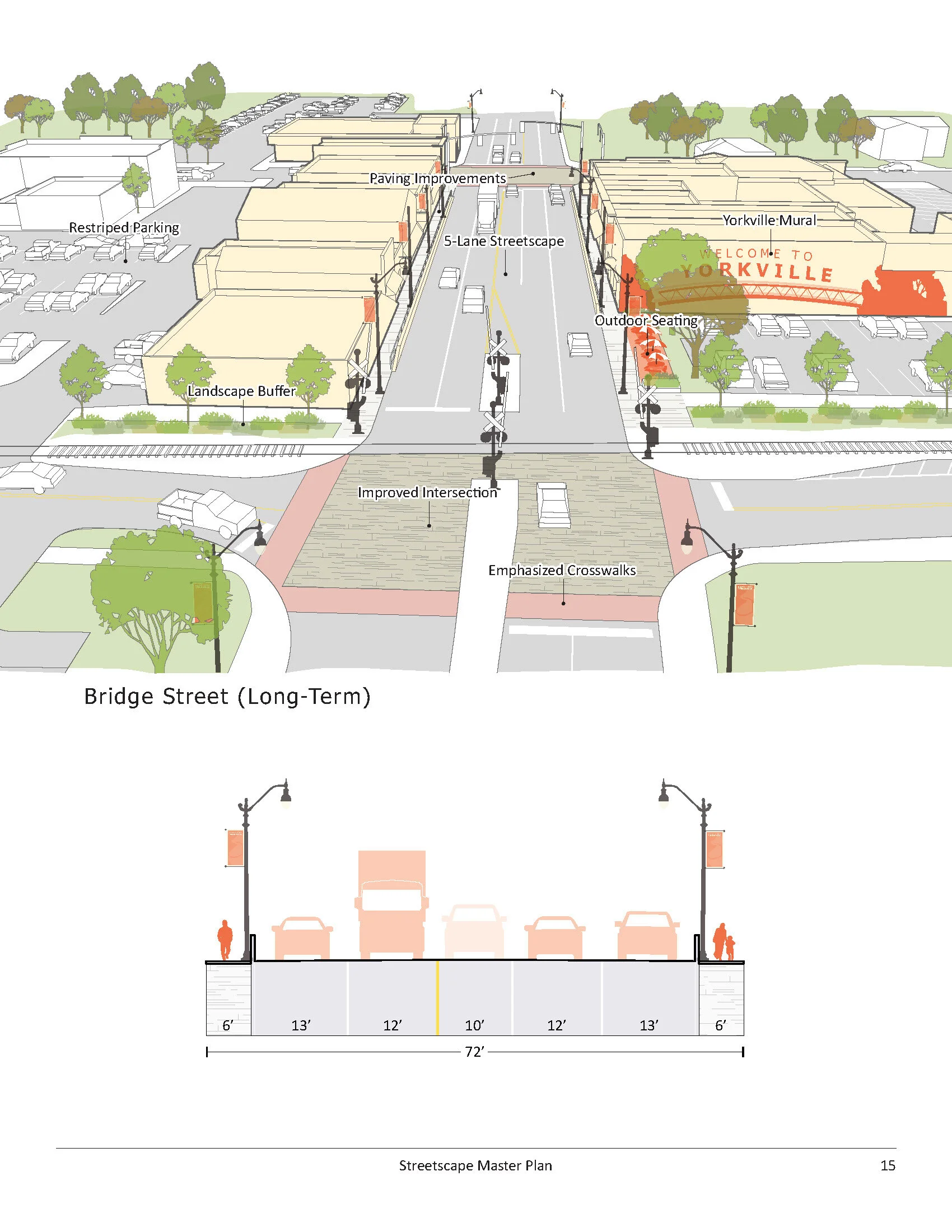

The project also included signage and wayfinding, and maintaining small details that uphold Yorkville’s charming downtown. Landscaping solutions, pavement types, and street accessories were all detailed in the master plan.
Effectively navigating downtown is one of the major elements to be improved. For example, there is currently sufficient parking to accommodate patrons of the downtown uses; however, that parking is dispersed unevenly throughout downtown and is difficult to locate unless you are familiar with the area. Situations, such as no left turns allowed at the Bridge Street and Hydraulic Street intersection, make it difficult to navigate if a turn is missed and an opportunity to redirect is not obvious.


